Trail:Tunnel
| Tunnel | |
|---|---|
| Single Track | 85 % |
| Fire Road | 0 % |
| Paved Road | 15 % |
| Total trail Length (miles) | 5 |
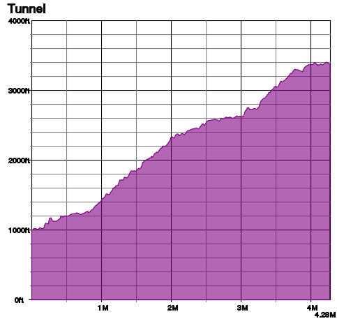
| Elevation Gain/Drop (feet) | 2200 |
| KML URL | |
| Location | 34° 27' 52", -119° 42' 45"
Loading map...
|
Contents
Trail Overview
Big time front country chunk when ridden from the top, and gateway to Jesusita when climbed from the bottom. The single track is very technical and challenging. Long travel bike recommended.
The "Tunnel" in the name refers to the Mission Tunnel that brings water from Gibraltar damn to the south coast. That means the origins of this trail go back to 1904 when tunnel construction started. The lower part of the trail is paved to provide access to the tunnel exit for maintenance. The trail quickly becomes rough the higher you go.
How to find It
The lower trail head is at the top of Tunnel Rd. This is a popular hiking trail, and parking is limited. Be sure you park either off the pavement or to the right of the white line. You can find the upper trail head on the map.
Typical Conditions
Current Conditions
Elevation Profile
Trail Image
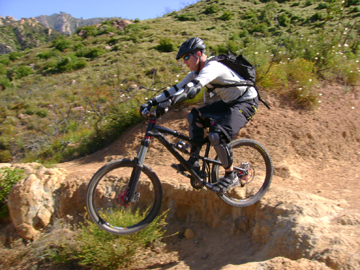
Tunnel2.jpg